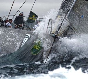
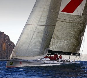
The last 10 miles of the Rolex Sydney to Hobart Yacht Race (from Iron Pot to the finish) has often been the graveyard of ambitions for many competitors. With the finish line in sight, fickle winds and tides make it a tactician’s nightmare, potentially wrecking an otherwise well-sailed race.
New tactical oceanographic data covering a large area of southeast Tasmania spanning South Cape, Tasman Peninsular, D’Entrecasteaux Channel, Storm Bay, the Derwent Estuary and up the Derwent River, is now available for the first time to competitors.

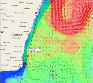
Tidetech’s CSIRO Southeast Tasmania Model
CSIRO Marine and Atmospheric Research has been conducting oceanographic studies in this area for years and has recently agreed to make available data from its state-of-the-art, high-resolution model that forecasts sea-surface height, current, temperature and salinity for this area through the Australian Ocean Data Network.
Tidetech’s scientific team has been working to technically manipulate this data, converting it to GRIB files that can be downloaded to navigation software.
Traditionally, Sydney to Hobart races have been won and lost in the last 30 miles. Wind can die after sunset; an often strong outflow from the Derwent River can have a huge effect (particularly after rain) by mixing with the tidal flow to make current patterns complex and unpredictable; river flow often stays in a narrow band all the way out to the Tasman Peninsular, enhanced by the ebb tide. With this new data, skippers and tacticians will have an opportunity to make the most of arguably one of the flukiest stretches of water in ocean yacht racing.

Tidetech CSIRO Derwent Estuary Model
Available as a subscription, Tidetech data is downloaded into onboard navigation software. With detailed graphical presentation users can select the information they want displayed including ocean current strength and direction, sea surface temperature and tidal streams. The data is presented in GRIB format which is compatible with the more popular race navigation and tactical software packages.

Tidetech CSIRO Storm Bay Model
Tidetech’s products are also available for use in the 2010 Melbourne to Hobart and Launceston to Hobart races.
Tidetech’s data has been used in many other regattas and races including the Melges 32 World’s, Rolex Big Boat Series (San Francisco), Sevenstar Round Britain and Ireland Race (the data was also used in the popular online game, Virtual Regatta, for the same race) and many others as far back as the 2008 Sydney to Hobart.
Tidetech is also in the running to provide oceanographic data to the forthcoming Volvo Ocean Race and 34th America’s Cup.